The creation of Uluru and Kata Tjuta as both were formed at the same time began over 500 million years ago. The two rocks were created at about the same time, however the way the two rocks formed are slightly different:
Formation of Uluru:
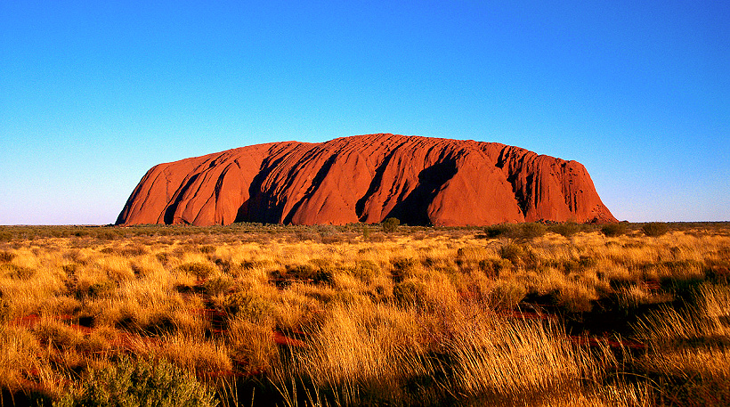
Around 500 million years ago big crustal blocks that form the
Australian continent came together. A block called the Musgrave Province pushed
up from the south creating mountains — the Petermann Ranges — in an event
called the Petermann Orogeny. When these mountain ranges first formed, they
were huge and as big as the Himalayas. However, as there was no plant cover the
mountain range eroded rapidly. After this an inland sea was located where Uluru
is now, depositing large amounts of sediments. These sediments eventually
formed rocks and formed what we now know as Uluru.
Formation of Kata Tjuta:
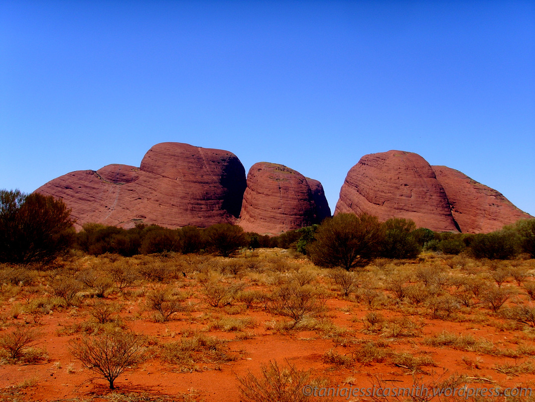
At times the Amadeus Basin was a shallow sea collecting sediments. The older sediments in the Amadeus Basin were crumpled and
buckled about 550 million years ago, and mountain ranges were uplifted in an
event the geologists call the Petermann Ranges Orogeny. At this time there were
no trees or grasses covering the landscape. Bacteria and algae were the only
life forms and they helped break down the jagged mountain ranges.
These bare mountains eroded easily. Huge amounts of sediment washed away when it rained and formed alluvial fans adjacent to the ranges. It is the remains of at least two of these alluvial fans that are seen today as Kata Tjuta.
The sea receded between 400 and 300 million years ago and the rocks were folded and fractured. This second major folding is called the Alice Springs Orogeny. It raised the region above sea level. The sand rocks at the surface eroded rapidly. This erosion still continues now at a slower rate.
Kata Tjuta is therefore the visible tips of huge rock slabs that extend far beneath the ground. It is possible they extend down to 6 kilometres.
